
The Regional Training Workshop on Advances in Remote Sensing Application in Water Resources Management has been held in Muscat, Oman on 17-19 February 2020 as one of the approved proposals of the 10th RCUWM Governing Board Meeting which had been held in 5 December 2019 in Tehran, Iran.
This event has been hosted by the Ministry of the Regional Municipalities and Water Resources (MRMWR), Sultanate of Oman and co-organized by MRMWR and RCUWM.
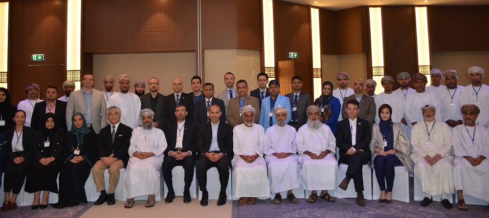
Around 60 participants from member states of RCUWM Governing Board, of whom 37% were female, and from states including Azerbaijan, Bangladesh, Egypt, Germany, India, Iran, Iraq, Oman, Pakistan, and Turkey participated in this event. Also participants from Kuwait (Institute of Scientific Research) and Qatar (UNESCO Doha Office) attended this workshop. Distinguished lecturers delivered their speech as follows:
• Ms. Khadija Al Aisari, Petroleum Development Oman (PDO)
• Mr. Toshio Koike, International Centre for Water Hazard and Risk Management (ICHARM), Japan
• Mr. Mohamed Abdallah, United Nation Food and Agriculture Organization (FAO), Egypt
• Mr. Yaseen Al Mula, Sultan Qaboos University (SQU)
• Mr. Mohamed E. Hereher, Sultan Qaboos University (SQU)
• Mr. Tobias Brehm, Federal Institute of Hydrology (BfG), Germany
• Ms. Fatma Al Lawati, Petroleum Development Oman (PDO)
• Mr. Ali Chavoshian, the Regional Centre on Urban Water Management (RCUWM), Iran
• Mr. Talal Al Awadhi, Sultan Qaboos University (SQU)
Furthermore, the 1 Million Date Palm Project and 2 traditional water transfer systems of Oman similar to Qanats which are called Falaj in Oman have been visited as a technical tour on the third day of the workshop (19 Feb).
The main objectives of this regional training workshop have been to:
• introduce recent developments in remote sensing information and satellite-based products (e.g. precipitation and soil moisture) as well as their applications,
• promote the exchange of experience and knowledge among participants and,
• discuss development and application of Decision Support System (DSS) using remote sensing information.
Special thanks to H.E. Ali Al-Abri, Undersecretary of MRMWR, Mr. Rashid Al-Abri, Director General of Assessment in MRMWR and Mr. Zaher Al-Suleimani from Oman Water Society for their efforts in holding this training workshop and Mr. Soleiman Obeidani, for the arrangements to have the technical tour, as well as many others without whom this workshop could not have been held successfully.
")
")
")
")
")
")
")
")
")
Downloads
Presentations
E-Learning Videos
E-Learning Videos: Catchment Delineation in QGIS_Part 1
E-Learning Videos: Catchment Delineation in QGIS_Part 2
E-Learning Videos: Catchment Delineation in QGIS_Part 3
E-Learning Videos: Catchment Delineation in QGIS_Part 4

